
-
Ashley Teifke
- December 20, 2024
- No Comments
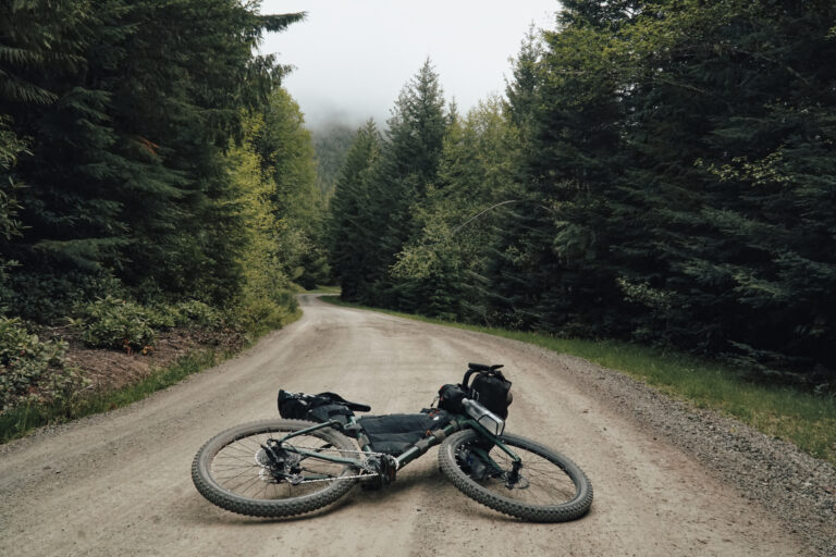
My Route Across the Olympic peninsula
Bottom Line... Riding in Traffic Sucks.
According to the CDC, every year almost 1,000 cyclists are killed and over 130,000 are injured in motor vehicle accidents. Bright clothing and lights aren’t always enough to ensure your safety while navigating busy roads on two wheels. You are always to some degree, placing your life in the hands of whoever is behind the wheel of the car zooming by. Personally, I prefer to take that risk out of the equation as much as possible. Fortunately, I’m not alone. After a bit of digging, I managed to find a bikepacking route that remained almost entirely off any main road.
The Crossing Washington Mountain Bike ROute
Enter, the Cross Washington Mountain Bike Route. A near 700-mile route beginning on the coast outside of Forks, WA that winds its way all the way across the state to the tiny town of Tekoa, WA on the Idaho state line. Created by Troy Hopwood, the route strings together forest service roads, paved bike paths, and flowy single track to create an experience free from the perpetual buzz of high-speed traffic. As such, it is not the most direct route across the state adding almost 200 miles to a trip taken strictly on pavement.
Navigation
Due to the remote nature of the route and potentially wet weather conditions, a GPS unit of some kind is highly recommended. I personally didn’t have a completely separate device and instead opted to download the .gpx file to the app “Ride With GPS” and navigate from my phone mounted on my handlebars. The route is continually being updated so it’s important to have the latest version downloaded.
The current GPX file can be found here.
Updated route information can be found here.
I turned on audible alerts that would notify me to where I needed to turn without looking down which proved to be extremely useful in the urban sections as there are countless twists and turns to find obscure sections of dirt. It did prove to be inconvenient when the rain began as I didn’t want to leave my phone exposed to torrential downpours. A Ziplock bag put over the entire phone and mount solved that problem so long as I didn’t need to touch the screen. A waterproof GPS Unit would be an ideal setup, but it is more than possible to navigate with your phone, a downloaded map, and a bit of creativity.

Route breakdown
When I pedaled away from the crashing waves on First Beach in the spring of 2023, I had every intention of riding the entire 700 miles to Idaho. As luck (or lack there of) would have it, I would only ride the 200 miles to Seattle. While it wasn’t the trip I had envisioned, the places I rode through over those 4 days introduced me to a kind of bike tour that I had never experienced before. While I can’t speak for the remaining 500 miles east of Seattle, let’s get take a peek at what those first 200 miles looked like.
La Push to Port Angeles:
Leaving the sand of First Beach, the first 20 mile stretch of pavement on Highway 110 is one of the only significant stretches on a main road. It fortunately is flat, relatively quiet, and goes by quickly. Before long the route turns up into the Olympic National Forest and the climbing begins. After slogging up and flying down 15 miles of remote gravel logging roads, riders receive a reprieve in the form of the Olympic Discovery Trail. The paved bike path continues all the way along Crescent Lake before turning on to the Olympic Adventure Trail. Beautifully maintained, flowy singletrack winds through old growth forest almost the rest of the way to Port Angeles. This is many riders’ favorite section of the entire route.

Port Angeles to Quilcene:
From Port Angeles the Discovery Trail resumes and the paved trail takes riders to Sequim where it once again turns up into the mountains. A brief segment on the paved road gives way to well-maintained dirt forest service roads all the way up the infamous Bon Jon Pass. When ridden with the grand depart in the spring, this is one of only a few places that still may have snow covering the roads. After conquering the pass, a fast decent down to the Upper Quilcene trailhead deposits riders at the start of another fun section of single track. Follow the trail over the river and through the rainforest because it’s to the tiny town of Quilcene we go.
Quilcene to Kingston:
Grab a delicious burger at Quilbilly’s Restaurant and Taproom before heading out of town along quiet country roads. Quickly becoming the theme, the pavement doesn’t last long before Mr. Hopwood finds more random logging roads to string together all the way to the Hood Canal Bridge. The Hood Canal bridge is one of the busiest sections of road that has to be ridden and unfortunately, the bridge doesn’t have much in the way of a shoulder. Thankfully though, more fun singletrack awaits on the other side through Port Gamble and the North Kitsap Heritage Parks. After arriving in Kingston, park the bike and grab some tasty treats from Jaime Les Crepe’s while waiting for the ferry to Edmonds.
Kingston to Bothell:
As my trip unfolded, this proved to be my final section. While the riding itself was not as challenging as previous segments, this is the beginning of the “Urban Section” of the route which is undoubtably the most difficult to navigate. Twisting and turning, the red line snakes through neighborhood parks, powerline trails, and the occasional bike path. Going through a Seattle suburb, it’s actually quite impressive how the route manages to stay off of the main roads almost entirely.
Who is this route for?
If you’re crunched on time and want the most efficient route across the peninsula, the Cross Washington is certainly not it. If you want the easiest possible route, this is also… not it. Long climbs and navigating tight single track on a loaded bike add in a bonus challenge that will slow down the fastest riders. The Cross Washington was created in an effort to stay off the beaten path wherever possible. If your goal is to explore some of the more remote, unseen nooks and crannies that Washington has to offer, this route will not disappoint. While my own trip didn’t go to plan, I had an incredible few days out there and am certainly planning on giving it a second go in the near future.
© 2024 Ashley Teifke