-
Ashley Teifke
- December 20, 2024
- No Comments
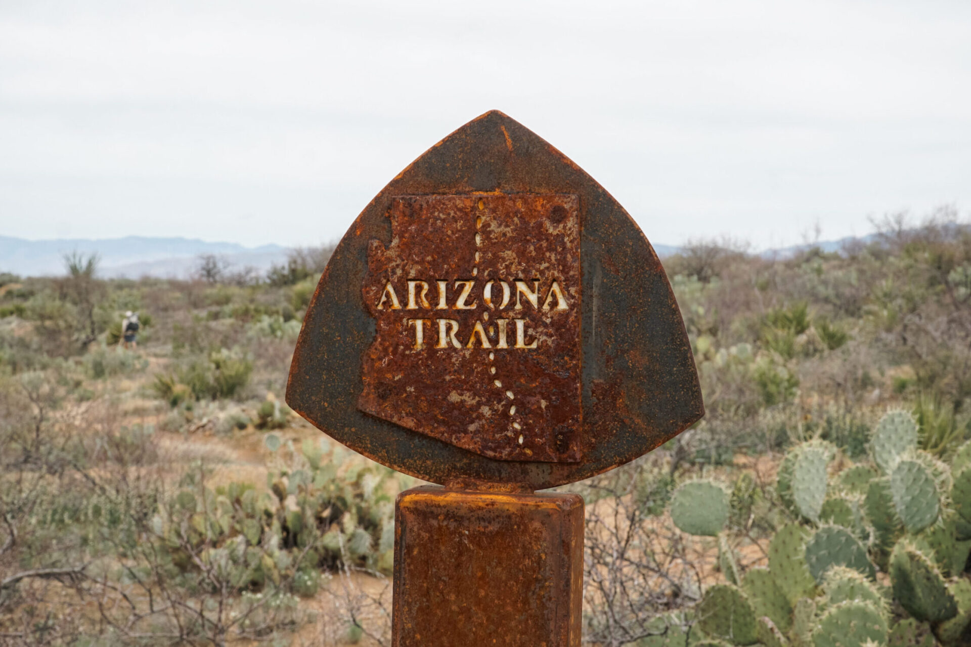
Northbound or southbound on the Arizona Trail?
NoBo > SoBo?
The Arizona Trail is one of those rare circumstances where one direction isn’t “better” or significantly more popular than the other. Generally, the decision is made based off the time of year you have available. For NoBo hikers a typical start date is anywhere between mid-March/April with the goal of finishing in May. This allows for cooler temperatures on the southern half of the trail and warmer temperatures once you climb up to the Kaibab Plateau. For SoBo hikers a typical start date would be around the end of September ideally finishing before the end of November. Temperatures will be starting to dip around freezing on the Plateau and there is a much lower probability of encountering triple digit heat waves in the southern section.
Northbound PROs
While the AZT is significantly less popular than any of the three triple crown trails (Pacific Crest, Appalachian, and Continental Divide Trails), a Nobo hike is considered the slightly more popular option. It never felt overly crowded but there is definitely a sizeable bubble that starts every spring and a very active network of top tier trail angels that frequently maintain water caches. Water is not difficult to find this time of year as most of the natural sources are flowing strong from the winter snow melt.
Though it varies year to year, weather in the spring is generally more favorable. Average temperatures between the 70-80 degrees are common for much of the trail.
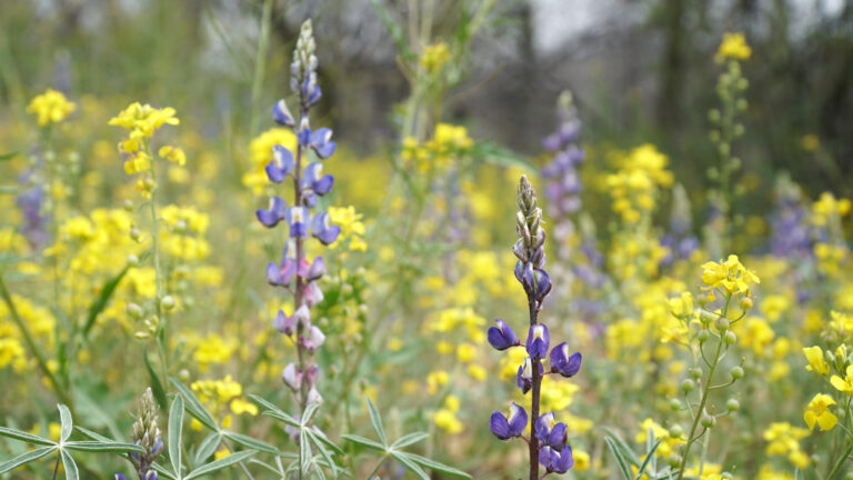
One the highlights of the southern half in the spring is undoubtedly the wildflowers. Never in my life had I seen a desert so vibrant and alive. Carpets of flowers every color imaginable covered the ground beneath towering cactus that were also adorned with flowers of their own.
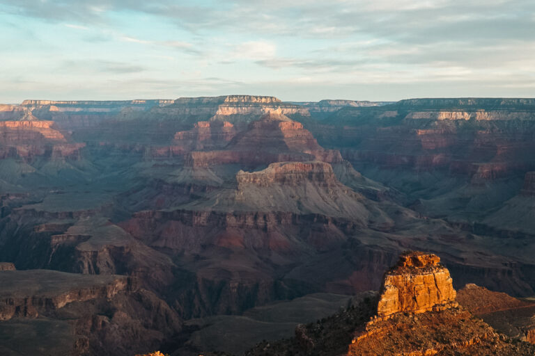
In terms of overall difficulty, the southern half is physically more challenging. Once you climb onto the Kaibab Plateau (around halfway) the topography begins to share a striking resemblance to a pancake. While this may mean some early suffering at the start, by then end you will feel like you’re flying the final 300 miles to Utah. By the time the Grand Canyon rolls around, you’ll be in the best shape possible and ready to tackle the challenge.
the NOBO Dirt
It’s not all sunshine and roses though, let’s have a look at some reasons why going north can really suck. For one, starting out with a monster 5,000ft climb up Miller Peak on day one can be a bit of a kick in the pants, particularly if it’s still covered in snow and ice. The good news though is it melts fast and is a short section. So, check the conditions, watch for a good weather window, and go for it. This pattern can repeat for the next several hundred miles as the trail climbs up to between 8,500 to 9,000ft in each of the sky islands (Miller Peak, Micah Mountain, Mount Lemmon).
While temperatures generally remain pleasant, it can still swing drastically in either direction on any given section of the trail. In the sky islands and higher elevation on the Plateau, freezing temperatures, lingering winter storms, and snow are still possible. At lower elevation triple digit days are still possible also and can be a real drag when they coincide with dryer sections of the trail.
Further north when the trail flattens out, the scenery turns to almost entirely to ponderosa pine forests. While beautiful in its own right, after 300 miles it can become a metal challenge as days bleed together without any noticeable change. Fondly referred to as the “ponderosa treadmill” it can certainly feel never-ending after passing through the diverse terrain of the south.
SoBo Pros
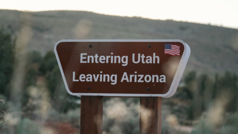
Now let’s head the other direction. Starting at the Utah border in the fall has some equally appealing qualities. For one, that ponderosa treadmill turns vibrant shades of oranges and yellows as the interspersed aspens begin to adopt their fall color. 300 miles of leaf peeping over very mild terrain (aside from the Grand Canyon of course, more on that later) is a wonderful way to start a thru hike.
Leaf peeping aside, the easier terrain makes it extremely easy to ease into your hike. By the time you arrive at the base of the Mazatzal Mountains coming off the Kaibab Plateau, you’ve already got several hundred miles under your feet and the beauty of the whole southern half to look forward to.
the SOBO Dirt
Let’s go back to the Grand Canyon for a second. While it certainly is an amazing way to start from a scenic perspective, it’s a pretty sizeable ditch to climb out of right off the bat. 9,200ft down from the north rim and 6,100ft back up to the south rim if we want to be specific. Regardless of direction, camping at Bright Angel Campground or Cottonwood Campground is highly recommended to break up the trip.
Nighttime temperatures on the Plateau will have begun to sink to around freezing while the southern half still remains fairly hot and sadly, void of wildflowers.
Another thing to keep in mind before setting out is that the spring snow melt will likely be long gone. Water sources like wildlife tanks and cow troughs will be notably lower and filled with more stagnant greenery than may be seen by Nobo’s in the spring. That said the amazing network of trail angels generally keep the caches maintained through the peak fall hiking season. As always, check cache statuses and be prepared for long carries if they prove empty.
But which is better?
When it’s all said and done, what it comes down to is what time you have available (spring or fall) and what you want to see (wildflowers or fall colors). Both directions have the potential for less-than-ideal weather so it’s a roll of the dice in that regard. As with all long trails, the Arizona Trail is rapidly increasing in popularity and will be interesting to see if one direction becomes significantly busier than the other. As it stands now a NoBo hike will be marginally more social than a Sobo hike, but the trail is beautiful in either direction, there certainly is no “right” direction.
© 2024 Ashley Teifke